
>Cycling & Mountain Biking
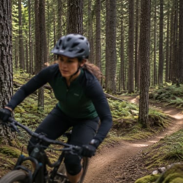
Cycling and mountain biking in the Columbia River Gorge offer everything from scenic road rides through river towns and rolling hills to rugged trail systems with forest, meadow, and cliffside views. Whether you want a relaxed paved ride or a more technical mountain bike route, the Gorge delivers big scenery with plenty of adventure.
Popular Locations
The Historic Columbia River Highway State Trail
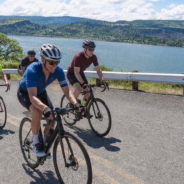
For cyclists, the Columbia River Gorge is one of the most spectacular rides in the Pacific Northwest. The Historic Columbia River Highway State Trail offers a rare opportunity: to pedal along dramatic cliffs, through historic tunnels, and past waterfalls — all on a paved, car-free trail that retraces Oregon’s first scenic highway. It’s also home to some of the Northwest’s most scenic mountain biking. From high alpine ridges with views of Mt. Hood to canyon rides above the Klickitat River, there’s a trail for every style of rider.
A Road Built for Scenery
When the original highway opened in the 1910s, it was celebrated as the “King of Roads.” Engineer Samuel Lancaster designed it to showcase the Gorge, with sweeping curves, stone viaducts, and tunnels that framed unforgettable views of the Columbia River.
While the construction of I-84 cut off much of the old road, Oregon has been gradually bringing it back to life — this time as a dedicated bike and pedestrian trail. Today, cyclists can ride several disconnected segments totaling more than a dozen miles, with more sections under active construction.
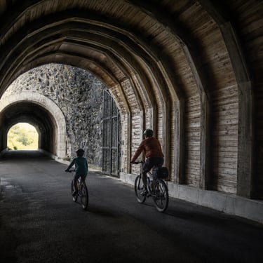
Mitchell Point Tunnel (The Star of the Show)
The biggest news for riders is the new Mitchell Point Tunnel, which opened in spring 2025. Modeled after the original 1915 tunnel — famous for its five arched windows — the new tunnel offers a dramatic, car-free experience and a direct link in the Gorge trail network.
Length 1.5 miles, paved and wide enough for comfortable cycling.
Highlights: Scenic arched windows with river views, stone masonry walls, and a plaza with picnic tables for mid-ride breaks.
Access: Connects with the Wyeth-to-Mitchell Point segment; a temporary path covers the last 0.7-mile gap until full construction is complete.
For cyclists, the tunnel is more than just a passage — it’s a historic ride reborn, and one of the most photogenic stretches of trail in Oregon. Here a few of the must-ride sections.
Bonneville Segment (Cascade Locks area)
Smooth pavement, gentle grades, and plenty of waterfalls make this stretch a classic. Perfect for families or casual cyclists. Trailheads at Toothrock, Eagle Creek, and Cascade Locks provide multiple ride options.
Wyeth to Mitchell Point
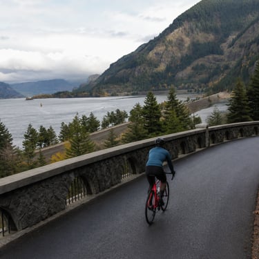
Nearly 6 miles of riding past waterfalls and over the Summit Creek Viaduct — a stone bridge that seems to float above the Gorge. Now capped by the Mitchell Point Tunnel, it’s becoming one of the trail’s signature rides.
Mosier Twin Tunnels
A favorite for road cyclists: 4.5 miles of river views, interpretive signs, and the cool shade of two restored tunnels. The steady grades make it accessible, while the views make it unforgettable.
Each section is fully paved, well-maintained, and closed to cars — meaning your biggest challenge will be deciding how many photo stops to make.
Ride Planning Tips
Best Bikes
Road bikes, gravel bikes, hybrids, and e-bikes all work well. Tires 28mm or wider are ideal for comfort.Access & Parking
Each segment has trailheads with parking, restrooms, and water. Wyeth, Viento, and Mosier are excellent starting points.
Difficulty
Most sections feature gentle grades (2–4%), making them approachable for all levels.Season
Spring brings waterfalls and wildflowers, summer offers warm dry riding, and fall colors light up the Gorge. Early mornings or weekdays mean fewer crowds.
Connections
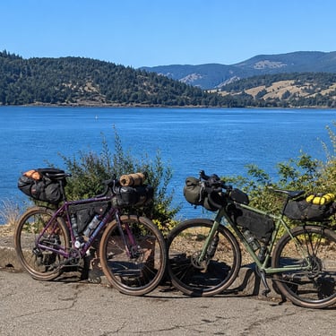
For long-distance cyclists, the trail links into portions of Historic Highway 30 still open to cars — but with far lighter traffic than I-84. Combining road and trail sections makes for big-mileage Gorge adventures.
The Road Ahead
With just a few gaps left to close, Oregon is steadily working toward a fully connected 73-mile car-free corridor through the Gorge. Future projects east of Mitchell Point will link the trail toward Hood River, giving cyclists even more continuous riding. When finished, riders will be able to pedal from Troutdale to The Dalles on a route that blends history, scenery, and adventure like no other in the country.


Copyright Ticklecreek Design - All Rights Reserved
Contact | Disclaimer