Wind & Kite Surfing_
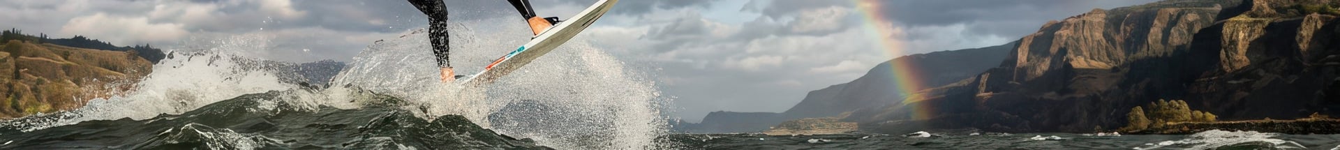
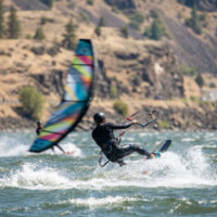
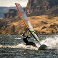
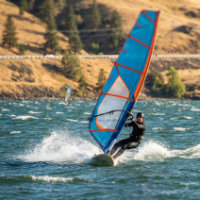
Wind and kite surfing have found their spiritual home in the Columbia River Gorge, where the river and the sky seem to conspire together in perfect partnership. The steady thermal winds that funnel through the canyon from late spring through early fall draw riders from around the world.
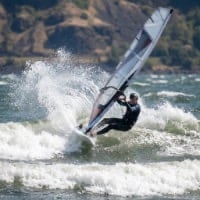
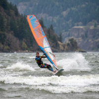
Few places in the world rival the Columbia River Gorge for windsurfing. Each spring, when the strong seasonal winds begin to sweep through the canyon, brightly colored sails dot the water like moving kites. Riders skim, jump, and carve across the river, taking advantage of one of the most consistent and powerful natural wind tunnels in North America.
The Gorge’s legendary winds are created by the clash of climates. Cool, moist air from the west meets the dry, hot air of the eastern deserts, creating a powerful pressure difference. This funnels Pacific air through the Cascade Mountains, producing steady winds that can last from March into late summer. By afternoon, those winds often grow stronger, providing ideal conditions for experts — while mornings can be calmer, perfect for learners.
The river itself adds to the appeal. Wide channels, protected coves, and rolling swells offer something for everyone — from beginners taking their first lesson to seasoned pros chasing big air.
Tips for Visitors
Check Conditions Before You Go
Wind strength can vary dramatically by site. Local hotlines like Bart’s Best Bet (541-386-3300) and K105’s wind line (541-386-1336 ext. 3) provide daily updates.Skill Levels Matter
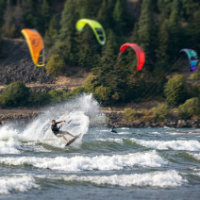
Beginners should stick to protected areas like Hood River’s Marina or The Hook, while advanced riders head for Swell City, The Hatchery, or Doug’s Beach.Watch & Learn
Even if you don’t ride, many sites are fantastic for watching windsurfers in action, especially on summer afternoons when the Gorge is alive with sails.
The Gorge is lined with windsurfing launch sites on both the Oregon and Washington sides of the river. Here are some of the most popular spots.
20 Popular Locations
Note: The regions shown are not officially designated; they are provided for reference and defined using highway milepost ranges. Washington mileposts appear above each region name, and Oregon mileposts appear below. In this section of the Gorge, the Columbia River forms the boundary between Washington and Oregon. Milepost numbers shown in the chart represent the closest highway mile marker and are approximate; used only to help indicate general location. In some cases, the nearest milepost may be past the actual destination and/or be a short distance away from the highway or milepost.
W = West (OR mileposts 19-34, WA mileposts 16-32)
CW = Central West (OR mileposts 34-50, WA mileposts 32-50)
C = Central (OR mileposts 50-65, WA mileposts 50-65)
CE = Central East (OR mileposts 65-84, WA mileposts 65-81)
E = East (OR mileposts 84-100, WA mileposts 81-96)
Copyright Ticklecreek Design - All Rights Reserved
Contact | Disclaimer